Most beautiful hiking trails in northern Germany and the center
Hiking is trendy. The more remote, the better. Take a break. Enjoy the views. Breathe fresh air. Experience silence. Forest bathing. Discover loneliness. A picnic make. There are many Places in Germanythat are suitable for this. We are looking for the most beautiful hiking trails in Germany. We therefore asked travel bloggers about their favorite hiking trail.
All hikes featured in this article were personally undertaken by the respective guest authors. They report firsthand on their experiences on the hiking trails in Northern Germany – with their own impressions, photos, and tips. This way, you get authentic recommendations directly from people who have completed the tours themselves. Each trail was explored individually, which makes the article particularly credible and helpful. You can therefore expect honest assessments and practical information.
The result is a collection of hikes in Germany that are worth exploring. Let yourself be whisked away to hiking regions that demonstrate just how diverse Germany's natural landscape is. Simply lace up your hiking boots, pack your hiking backpack, and pack everything you need for a day of hiking. Let's go! Here you'll find the most beautiful hiking trails in Northern Germany, suggested by travel bloggers.
Our advice: Check out our hiking tips for autumn in Germany.
What you need for a hike
- The hiking paths are sometimes rough. Find comfortable walking shoes for wide feet here
- Check our hiking checklist whether you have packed everything for your hike.
- Make sure to bring a large backpack with you, because there are not always places to stop for a snack on the way.
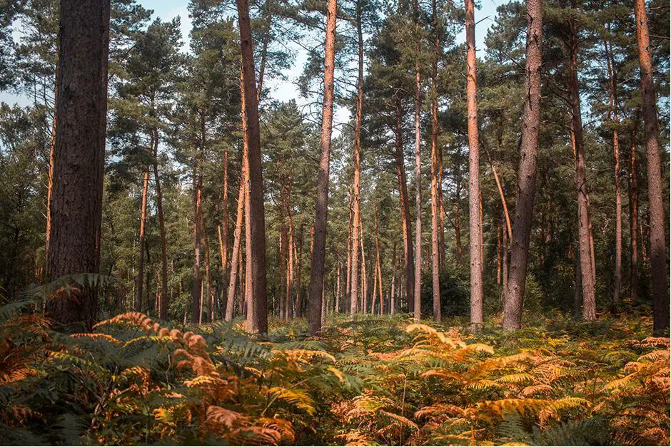
Hiking trails in Germany - North
Premium hiking trail Galgenvenn in Nettetal
The Lower Rhine is rather inconspicuous when it comes to hiking. But the Premium hiking trail Galgenvenn in Nettetal is well worth it and in 2016 it was even named the second most beautiful hiking trail in Germany. It is accessible all year round and with 11,2 km (approx. 3 - 4 hours depending on the pace and breaks) it is also suitable for beginners. The path is, however, partly narrow and hilly, therefore not recommended with a pram.
The hiking trail leads through the Schwalm-Nette Nature Park Through the border forest between Germany and the Netherlands, with a quick visit to the Netherlands. Only the last 2 km or so lead past the edge of the forest and across a field – it gets hot here in summer!
The landscape may not have any mountains. But it is no less varied as a result. Typically for the Lower Rhine, the hiking trail leads through forest, meadows, Venn moor and heather. Behind every turn there is a view!
Animal lovers are not neglected either. The Schwalm-Nette nature park is a habitat for endangered and rare animal species such as fish, frogs, newts and dragonflies.
The hiking trail is easy to reach by car. There are parking spaces for hikers in the area and, with Haus Galgenvenn as the start and end point, there is also a place to stop for refreshments. If you want to see more afterwards, you can visit the Sequoiafarm Kaldenkirchen and marvel at 70-year-old sequoia trees!
About Nilsa Travels
Nils and Isabell from the “Nilsa Travels” blog come from Korschenbroich am Niederrhein and write on their blog about travel tips for city trips, short breaks, day trips and hiking trips in and around NRW. They show on their blog that you don't have to travel far for city trips and landscapes and that you can get that holiday feeling back home within a day.
Do you like to travel by motorhome?
- Do you want to rent a motorhome? Then you will find information here as well as booking options. Or do you like to travel with a roof tent on the car? Also the overnight stay in camping tents is possible.
- Check our packing list for campers to see whether you have packed everything for your motorhome tour.
- You want to know where you can stay overnight stay overnight in Germany and are you looking for parking spaces for RVs and campsites? You can find information about this under this link. There you can prepare your dinner in a Dutch Oven or on the portable grill . You can also find Dutch oven accessories here.
- Why is a folding e-bike useful when camping?
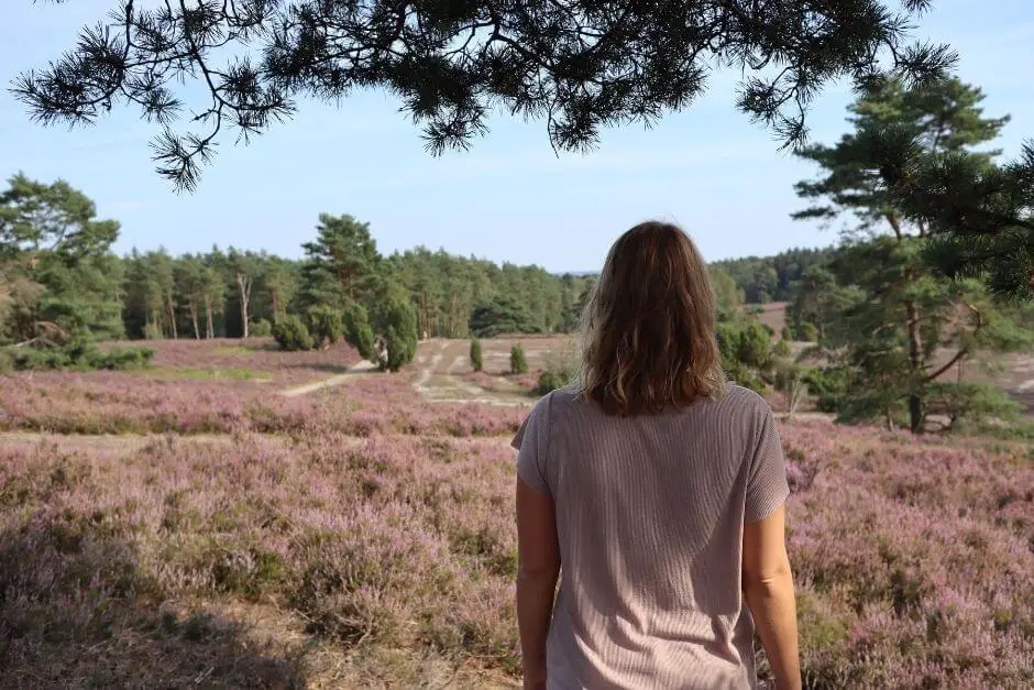
Hiking through the Büsenbach valley in the Lüneburg Heath
During its heyday in August and September, the Lüneburg Heath is a guarantee for a break from Hamburg's city life every year. Therefore, I can recommend this region to everyone for a hiking excursion. The Heidschnuckenweg runs through the area of the Lüneburg Heath. This is a more than 200 km long long-distance hiking trail. From the outskirts of Hamburg to the city of Celle, you can explore the heath area on hiking trails. The Heidschnuckenweg is particularly suitable for beginners. The highest elevation along the way is only 169 meters. Welcome to Northern Germany!
The Heidschnuckenweg is divided into 13 stages, which you can view in detail here. There you'll also find information about places to stop for refreshments. Although the stages aren't circular hikes, you can still easily return to your starting point from many locations using public transport. The Heide Shuttle Bus and the Erixx - the "Heidesprinter Bahn" - operate at many locations along the trail.
My advice? The stage of the Heidschnuckenweg between Buchholz and Handeloh. Here you pass the Büsenbachtal and should plan a stop at the Café Schafstall. After your hike, you deserve the selection of coffee and cake there!
A different kind of vacation
Isi is part of the blogger duo from Urlaub mal anders. Together with her blog colleague Angie, she reports on travel destinations beyond mass tourism. With them you will find inspiration for travel destinations, accommodations or even one or the other activity.
Do you like to have a picnic while hiking?
- Do you already know the nicest picnic spots in Germany?
- You need these utensils for a picnic on a hike
- Should it be a long picnic, you can find more picnic ideas here.
Hiking trails in Germany - Mitte
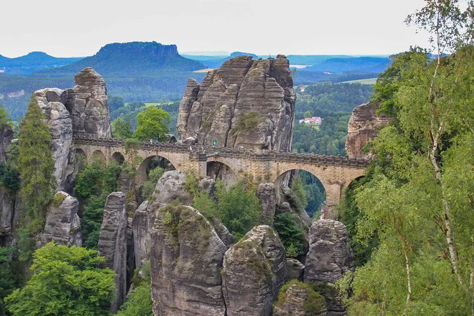
Circular hike to the fisherman's bastion
The region of Saxon Switzerland, a nature reserve near Dresden, is beautiful and a hiking highlight. While hiking, you can enjoy a backdrop of forests, the Elbe and rock formations that tower spectacularly into the air.
One of the hiking routes leads from the spa town of Rathen in Saxony past the Amselsee and the Schwedenlöcher. We continue up to the Fisherman's Bastion, the main attraction of the region.
The starting point of the hike is at the parking lot in Oberrathen, right by the ferry. The yaw ferry takes you across to the other side of the Elbe. This is where the march begins. The first stage leads to the Amselsee, where you have the opportunity to take a rowing boat. Then it's about 20 minutes on to the Schwedenlöcher. There the path slowly narrows. It winds through the rocks, sometimes over more than 700 steps and ladders, up towards the bastion. After almost two kilometers you will reach the Berghotel Bastei. From there you are at the main attraction of the hike in no time, the Bastei bridge with a length of 76 meters. From here you can enjoy a view of the rocky landscape.
If you like, you can choose a different route back: for example via the Malerweg to Wehlen. From there you can take the train back to Rathen, the starting point of the hike.
You can plan around 3 and a half hours for the hike with breaks and a visit. Distance is about 30-8 kilometers. The hike can be classified as moderately difficult. Good footwear and good physical condition are definitely a must due to the steps!
About PlacesofJuma
On In PlacesofJuma Martina & Jürgen write about their travels around the globe. The two love photography and are therefore always on the lookout for the most beautiful spots and locations.
You can order hiking guides for Germany here.*
If you purchase via a link marked *, we receive a commission, which we use to run this blog.
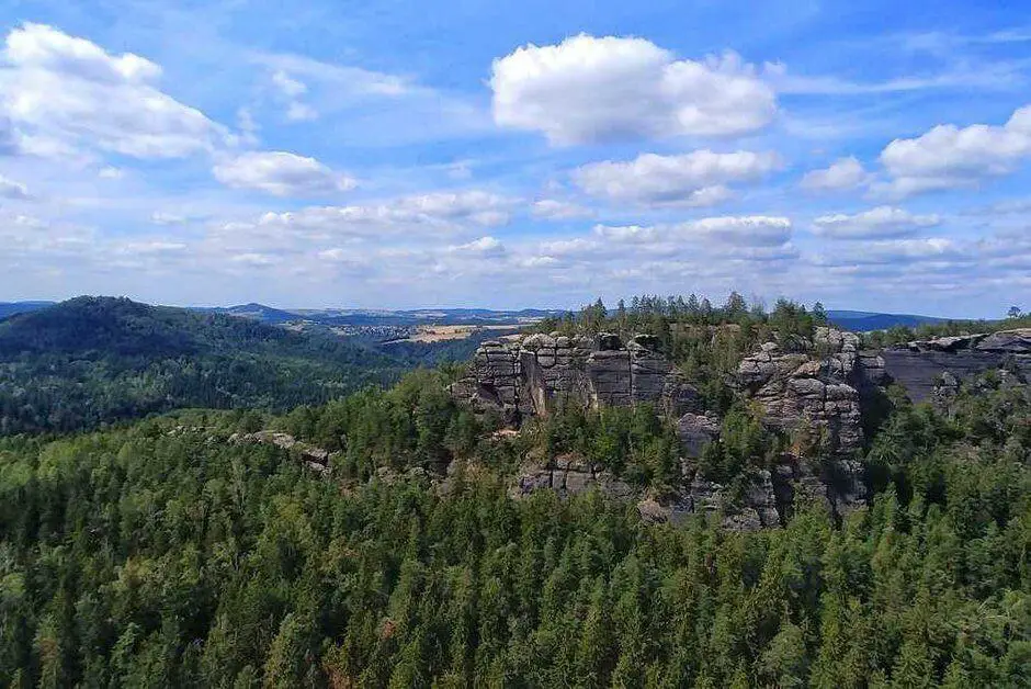
The Obere Affensteinpromenade - hiking trail in Saxon Switzerland
The Upper Affenstein Promenade is my favorite hike in Germany and is located in Saxon Switzerland. The area is known for its rocky peaks and views. It is located in eastern Germany and offers many hikes. Upper Affenstein Promenade is my favorite. The tour is pleasantly walkable, as it leads along a kind of plateau. It only requires an ascent and descent of just under 300 meters at the beginning and end. Due to narrow paths and steep slopes, this hike is not suitable for strollers, wheelchair users, or small children. Older children, however, will certainly have fun thanks to the terrain.
The Upper Affenstein Promenade is so special because it completely circles the pinnacles of the Affensteine. It offers panoramic views of the Saxon Switzerland National Park. There is also a varied path. This also contains some stairs and ladders that are typical for the Elbe Sandstone Mountains. In addition, with the sand hole, the small Prebischtor or the Idagrotte there are other sights along the hiking route. The tour starts at the hiking car park Nasser Grund and then leads once on the middle level around the Affensteine. You can find the GPS trail in the Blog.
There are no inns or restaurants along the Upper Affenstein Promenade. It is therefore advisable to take food with you for this 4-5 hour hike. The most spectacular picknick place is the Idagrotto, a cave and rock ledge at the same time, which can only be reached via a path and offers views and space to sit (on the rocks).
The hike along the Upper Affenstein Promenade can be done all year round. It is better to avoid rain, snow and ice, as otherwise there is no surefootedness. Anyone who embarks on this tour is guaranteed to come back with impressions and photos.
Via My-Travelworld.de
If you want to know more about Saxon Switzerland and Christian's travels, you can visit his travel blog My Travelworld. He has traveled to over 70 countries and his desire to travel is still unbroken. Therefore, he is currently touring the world as a digital nomad with a home base in the Dominican Republic. In between, however, he also visits his home town of Dresden and Saxon Switzerland from time to time.
You can order hiking maps for Germany here*.
If you purchase via a link marked *, we receive a commission, which we use to run this blog.
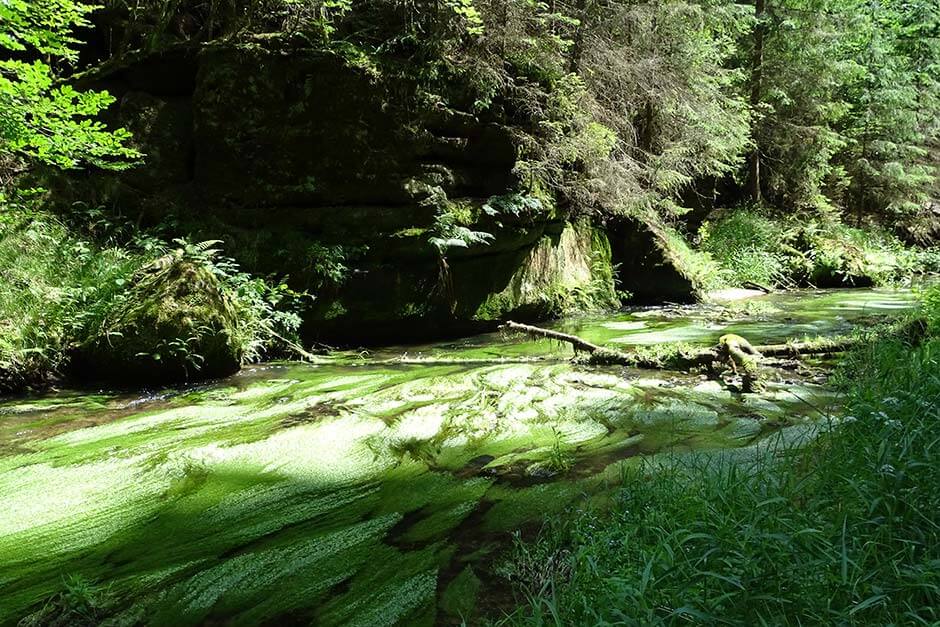
Hiking trail through the Kirnitzschtal in Saxon Switzerland
One of the most beautiful hikes I've done took me to the Kirnitzschtal in Saxon SwitzerlandThe Kirnitzsch Gorge is known to visitors from the boat trips that take place there. It's less well known that you can also continue hiking from the end of the boat tour. First, from the Buchenparkhalle in Hinterhermsdorf, the trail descends for about two kilometers, dropping almost 200 meters in elevation, to the Upper Lock. Whether with or without a boat trip: The hiking trail follows the course of the Kirnitzsch, sometimes up above the forest, then down again along the riverbank. The gradients are moderate. The last two kilometers back through the forest are quite challenging. We have to climb the 200 meters back to the parking lot.
We did the hike in summer so we could enjoy the forest in its green and the river with its dragonflies. It is certainly beautiful there in autumn too. Then the mist lies over the water and the leaves change color. It can get slippery in winter or when it rains. The hike is ten to twelve kilometers long, depending on your mood. The small round goes over the Zollweg, the large round to the Niedere Schleuse. Since we were making slow progress, we had enough with the ten kilometer route. There are no rest stops except at the parking lot. It is therefore advisable to take provisions with you. You can unpack it in a place in the forest or by the water.
About Ferngeweht
Sabine writes about traveling all over the world on her blog Ferngeweht. Mostly it goes into nature, always with respect for the country and its people.
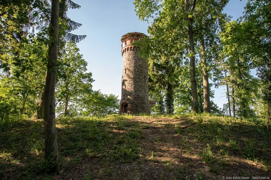
Hike along the Werbellinsee from Eichhorst to Altenhof
The 13 km long Werbellinsee is located northeast of Berlin in Barnimer Land. There are hiking opportunities around the second deepest lake in Brandenburg, from walks to difficult hikes.
One of my most beautiful Hikes along the Werbellinsee is the section from the municipality of Eichhorst to Altenhof. It is a moderately difficult route of approx. 20 km. The hiking trails are paved near the communities and become hiking trails on forest floor that is easy to walk on. There are inclines and roots that meander across the path.
The most beautiful time for the hiking trail is late summer and autumn, when the trees in the Schorfheide-Chorin biosphere reserve slowly turn golden.
In Eichhorst the hiking trail along the Werbellin CanalHere stands the 12 m high Askanierturm (Ascanian Tower) from 1879. Nearby is a wooden bridge that leads to the other side of the river.
There are refreshment stops in both communities. In Eichhorst and Altenhof there is a fisherman who sells fish rolls and smoked fish. Hikers can also fortify themselves in the ice cream parlor or in restaurants serving local dishes. That works, for example, in the Fontane Hotel in Altenhof. Apropos Fontane - it is said that Theodor Fontane was sitting in Altenhof on the bank of the Werbellinsee and said: "It is a fairy tale place where we sit, because we are sitting on the bank of the Werbellin."
If you want to return to Eichhorst after your hike, you can take the Werbellinseebus line 917 in the summer months and on public holidays.
About GoOnTravel
Anne-Katrin and Anja have been writing about travel destinations around the globe on GoOnTravel.de since 2015. The focus is primarily on Africa, Europe and America. But the reader will also find recommendations about their homeland Brandenburg and their adopted home Sylt (Anne-Katrin) and Berlin (Anja). In addition to travel tips, they have tips on (travel) photography.
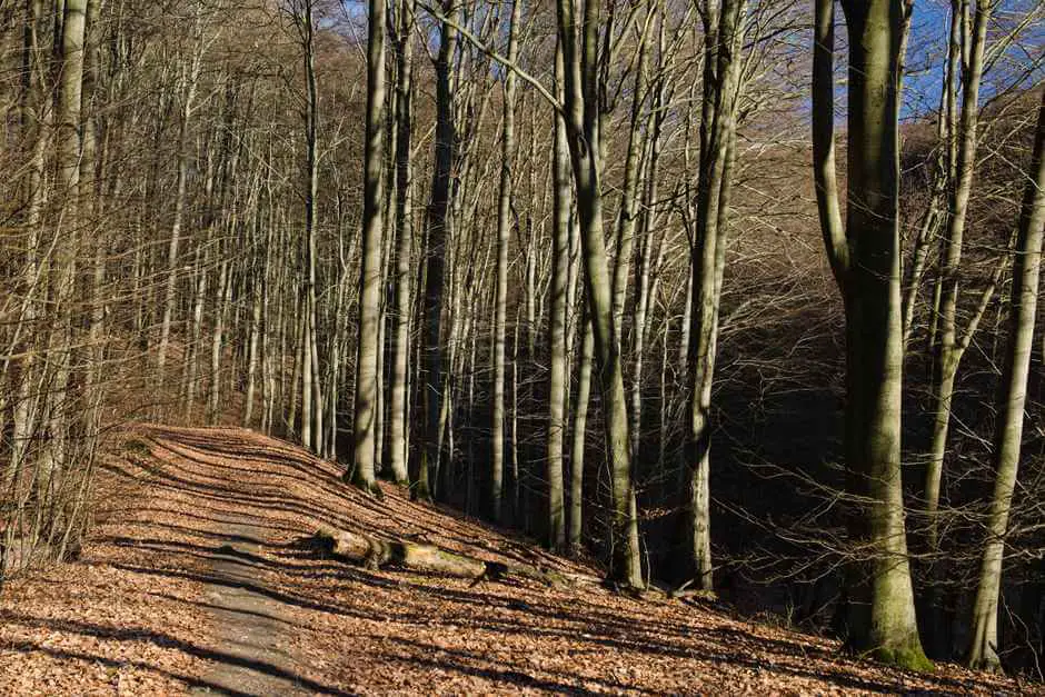
Once through the Grumsiner beech forest in the Uckermark
As city dwellers living in the heart of Berlin, we love to head out into the countryside on the weekends and simply enjoy nature. This is especially true in the Uckermark region. While we have many ideas for hikes in the most beautiful suburbs in the world, one in particular has stuck in our minds. The hike through the Grumsiner Beech ForestThe 6,5-kilometer circular trail passes moors and 180-year-old beech trees, which tower 30 meters above the forest floor. The trail itself is easy and on flat terrain. Since it leads directly through the forest, it's also perfect in summer. The beech trees offer shelter then. We did the hike in autumn and particularly enjoyed the colorful leaves and autumn light.
It all starts in Altkünkendorf. In addition to the medieval stone church, there are tips for the hike in the info booth. You start in a westerly direction and turn left at the intersection onto the country road. After a few hundred meters you are in the forest. From here, striking, orange-colored beech leaves on the trees point the way. From now on it goes through a hilly roller coaster landscape, which was shaped by the Ice Age, through the forest that has been left entirely to itself. Don't be surprised if one or the other tree trunk becomes an obstacle on the hiking trail.
At the end of the circular route, what is probably the most beautiful wooden bench stands picturesquely in a field. If you have your picnic with you, you should definitely unpack it here and enjoy the view over the fields and into the forest. And if you feel like hiking even more, you should definitely walk to the Grumsiner distillery after the hike and try the homemade gin.
About Anna & Clemens from Travelers Archive
We are travel addicts and passionate writers who actually feel most comfortable in Southeast Asian markets, in remote fishing villages in West Africa or on long road trips, but now and then also disappear into Berlin's bacon belt. On our blog Travelers Archive you can find a mix of travel stories and travel reports from all over the world.
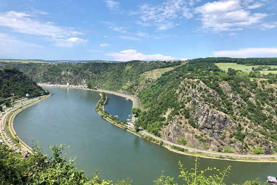
On the way on the RheinBurgenWeg, 04th stage (Oberwesel - St. Goar)
Why is it so beautiful on the Rhine? This question from the folk song can be answered by a Hike on the Rhine Castle Trail Easy to answer. The Upper Middle Rhine Valley has been a UNESCO World Heritage Site since 2002. In the steep valley between Bingen / Rüdesheim and Koblenz, you'll find castles, vineyards, and picturesque viewpoints.
The start of the hike is at Elfenley in Oberwesel, the "city of towers and wine". Past the city wall, it is now longer uphill: Either through the vineyards to the film set “Günderodehaus”, where we take a break with refreshing drinks or pastries and the view of Oberwesel. Or over the adventurous Oelsbergsteig with some alpine climbing passages consisting of step stirrups and ladders. Below the village of Urbar, the path now goes rather flat on the Rheinhöhen plateau to the Loreley lookout point Maria Ruh. Here you can either make yourself comfortable on the numerous picnic benches or stop in the local café with a beer garden.
Now it goes a long way into the valley before the path climbs up to the plateau again. Along the edge of the slope you have views again of the harbor on the Loreley, Katz Castle over St. Goarshausen and St. Goar with the huge Rheinfels castle ruins and the castle hotel of the same name.
This is followed by the descent to St. Goar over many steps, where the stage changes near the train station above the old town.
Why is it so beautiful on the Rhine? You should be able to answer this question by now at the latest.
About journication
Philipp reports on his travel blog JOURNICATION of experiences and adventures from all over the world. He has already traveled to over 95 countries, but is still deeply connected to his homeland: a village opposite the Loreley Rock in the UNESCO World Heritage Site of the Upper Middle Rhine Valley.
Further tips and information for hikers
More hiking trails in Northern Germany
Hiking in the nature park Hoher Fläming
A quiet hiking trail in Brandenburg, ideal for those who appreciate flat landscapes and solitude.
👉 Hiking in the nature park Hoher Fläming
Treetop walks in Germany
Discover the “Heidehimmel” in the Lüneburg Heath – a highlight for nature lovers.
👉 Treetop walks in Germany
🥾 Hiking tips & equipment
packing list for hikers
Practical checklist for your next hike – from shoes to lunch box.
👉 packing list for hikers
🍷 Hiking & Wine Regions
Wine hiking in Franconia
Perfect for connoisseurs: hiking through vineyards with a stop at a wine tavern.
👉 Wine hiking in Franconia
🧭 Discover more hiking regions
Hiking in Germany – Overview
Inspiration for hikes throughout Germany – from north to south.
👉 Hiking in Germany
Hiking in the Chiemgau
Easy hikes for connoisseurs in the Chiemgau Alps and around Lake Chiemsee.
👉 Hiking in the Chiemgau
We would like to extend our sincere thanks to all the travel bloggers for their hiking suggestions in Northern and Central Germany. We've compiled a fantastic collection of hikes. Be inspired and use their information for your own hikes in these beautiful places. hiking trails in Northern Germany are worth exploring. Do you also like going hiking in southern Germany? Then you can find it here, for example the most beautiful hiking trails in southern Germany.

Do you know this?
- The historic old town of Stein am Rhein
- Walser culture around Mittelberg
- Discover the beauty of Plitvice Lakes National Park, Croatia
- Getting married in Las Vegas – a phenomenon
- Which rain jacket is the best?
- Gifts for hikers
- Dutch oven sizes
- Germany vacation and travel tips
- Camping accessories store
Source: Hiking suggestions from the participating travel bloggers
Text hiking trails in northern Germany: © Copyright Monika Fuchs and TravelWorldOnline, as well as the participating travel bloggers
Photos: © Copyright Canva and the participating travel bloggers

A couple of great hikes came together! Thank you for letting me be there too. I'll go plan a couple of hiking tours ...
You're right. We are already thinking about where to hike. Many thanks also for your contribution.